Explore the official NASA Artemis landing sites. Learn why the Lunar South Pole was chosen and discover the maps for the Artemis 3 mission.
Use our interactive flash cards below to see the differences between Apollo and Artemis!
Why the South Pole? The Quest for Water Ice
The selection of Artemis landing sites is driven by one thing: Resources. The South Pole contains regions that have not seen sunlight for billions of years.
- Permanently Shadowed Regions (PSRs): These craters act as “cold traps” where temperatures drop to -230°C.
- Volatiles: Scientific data suggests these shadows contain significant deposits of water ice.
- Peaks of Eternal Light: Nearby crater rims that receive near-constant sunlight, perfect for solar power generation.
Space Adventure SLS Rocket Model (1/235)
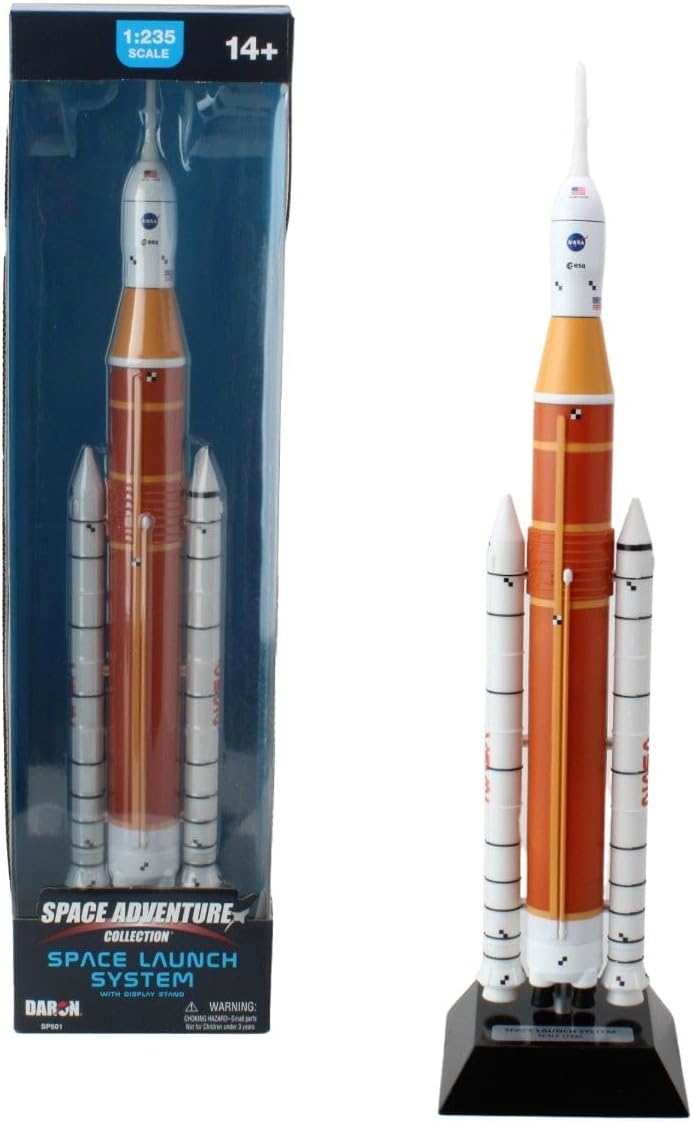
Bring the Artemis mission home! This meticulously crafted 1/235 scale replica of the Space Launch System features intricate details from the rocket stages to the propulsion systems.
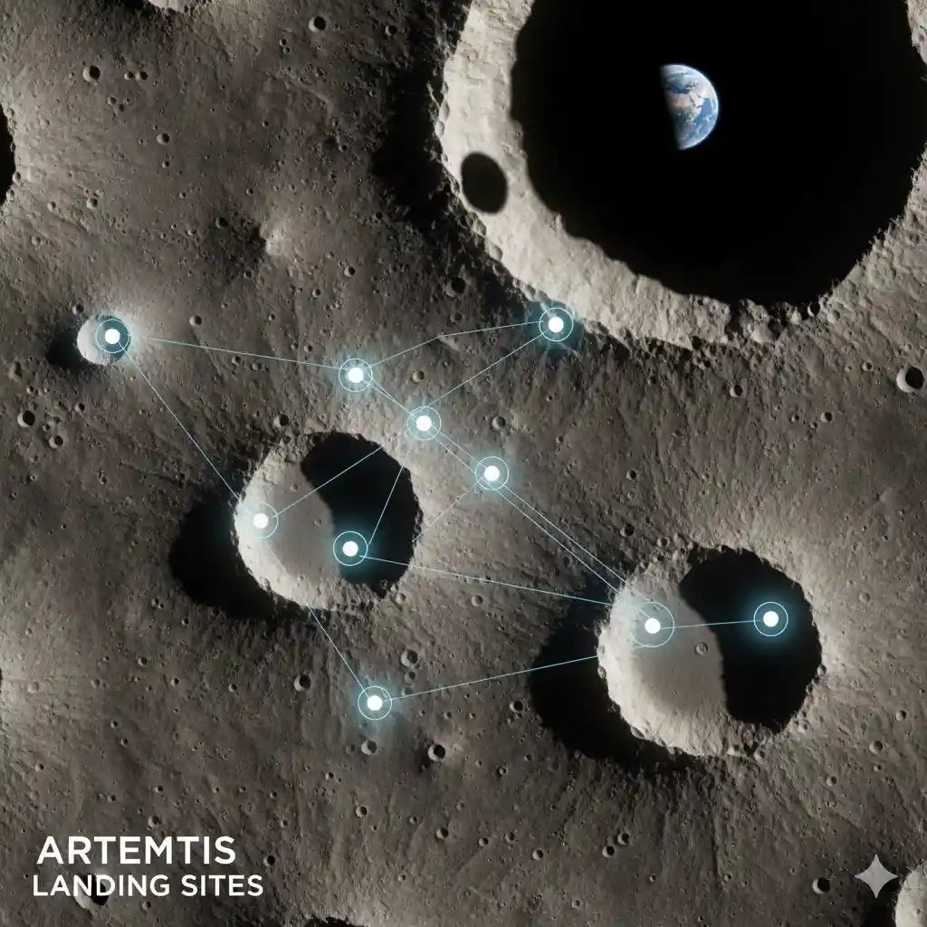
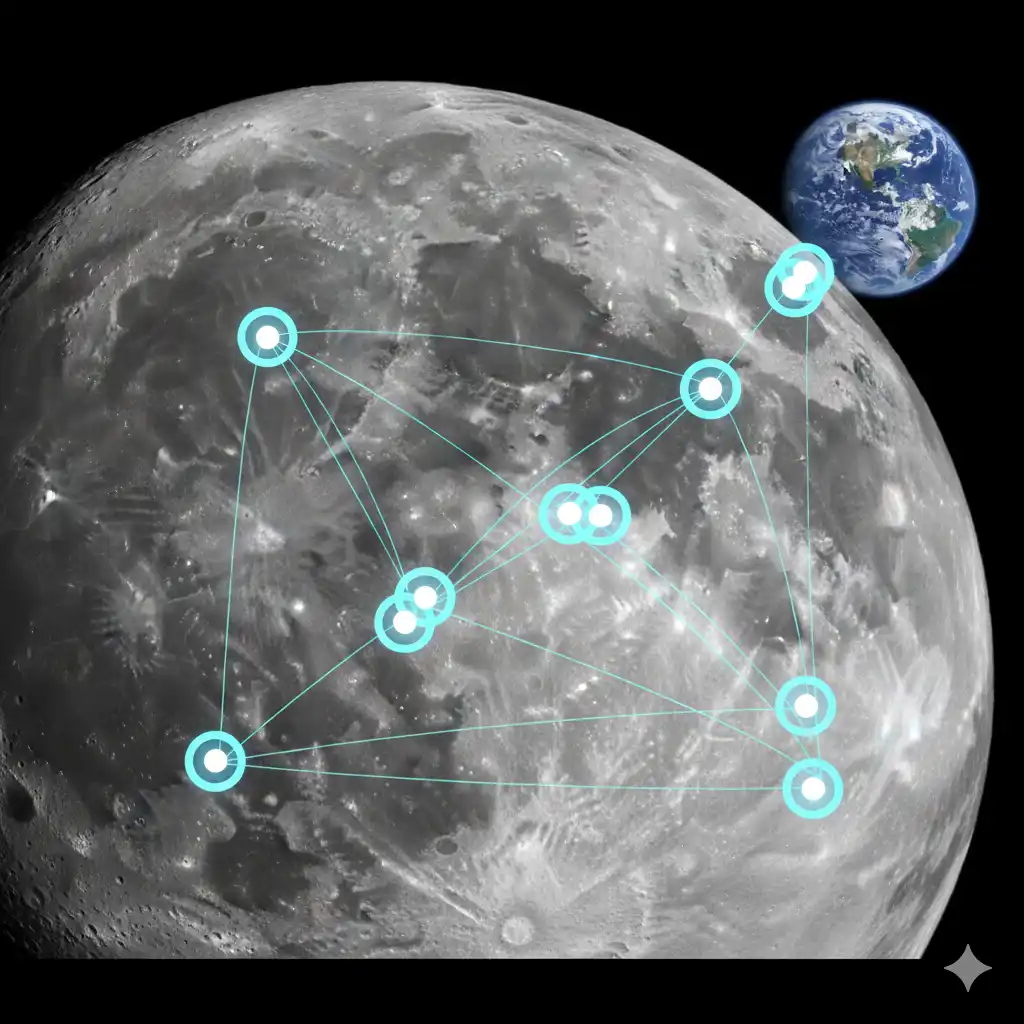
Check Price on Amazon →The Candidate Regions for Artemis 3
NASA has identified several candidate landing regions. Each is approximately 15 x 15 kilometers. The final site will be chosen based on launch timing and lighting conditions.
1. Shackleton Connecting Ridge
Located near the Shackleton crater, this site offers high sun visibility for power and is within trekking distance of deep, ice-rich shadows.
2. Peak Near Shackleton
This mountainous area provides a strategic vantage point and some of the most consistent solar illumination on the entire Moon.
3. de Gerlache Rim
A complex area of craters. Scientists are particularly interested in this site because the terrain may hold different types of ancient lunar soil (regolith) than other regions.
Interactive Comparison: Apollo vs. Artemis
To understand the difficulty of the Artemis landing, we must compare it to the 1960s.
Location
Card 1 of 4
APOLLO
Lunar Equator (Nearside)
ARTEMIS
Lunar South Pole
How Starship HLS Will Land
The landing process for Artemis is a marvel of modern engineering. Because the South Pole is so rugged, the Starship HLS (Human Landing System) uses a suite of sensors called NDL (Navigation Doppler Lidar) and TRN (Terrain Relative Navigation).
- Orion Docking: Astronauts move from the Orion capsule to Starship HLS in lunar orbit.
- Descent: Starship performs a vertical descent, scanning the ground in real-time to avoid boulders and craters.
- Touchdown: Using its massive landing legs, Starship stabilizes on the uneven lunar surface.
FAQ: Exploring the Lunar Surface
Not easily. Because the sites are on the very “edge” (limb) of the Moon at the South Pole, they are difficult to observe with backyard telescopes. However, high-resolution imagery from the Lunar Reconnaissance Orbiter (LRO) provides us with detailed maps.
The Apollo sites have been thoroughly studied. While historically significant, they lack the water ice necessary to build a permanent base. To go to Mars, we must first learn to “live off the land” at the South Pole.
The lunar “soil” or regolith at the poles is thought to be fluffier and less compacted than at the equator. This is why the Starship HLS landing legs are designed with a wide footprint to prevent sinking.
The landing sites are chosen so that the “Peaks of Eternal Light” provide solar power, while advanced battery systems and potentially small nuclear fission reactors will provide warmth during the long lunar nights.